
Around 1,300 hectares were deforested for sugarcane between 2011 and 2014 in northern Bolivia, with 600 more hectares cleared between July and September 2016. RAI flew over the area to investigate the extent of the issue.
By Eduardo Franco Berton / RAI
• Satellite data indicate deforestation for sugarcane in the northern portion of the country near Madidi National Park is ramping up as the San Buenaventura sugar mill expands production in the area.
• Nearly 2,000 hectares have been cleared for sugarcane so far, with a total of 11,700 hectares planned for cultivation by 2023.
• The Tacana Indigenous community alleges it was forced to concede 4,000 hectares of its ancestral territory for the construction of the mill.
• Deforestation already affects 20 percent of the Pan Amazon, and scientists warn that if it continues at this pace, it could produce an ecological collapse in less than 40 years.
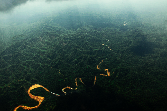
I am flying over Madidi National Park in a Cessna 172 aircraft. From the air, the phrase “green ocean” used by some scientists to describe the Amazon, makes more sense now. Behind the lens of my Nikon, the imposing Tuichi River makes its way through the jungle like a fleeing snake. As I observe, I remember the book “Back from Tuichi” which tells the incredible survival story of Yossi Ghinsberg, an Israelite who was lost for 21 days in this region of Madidi.
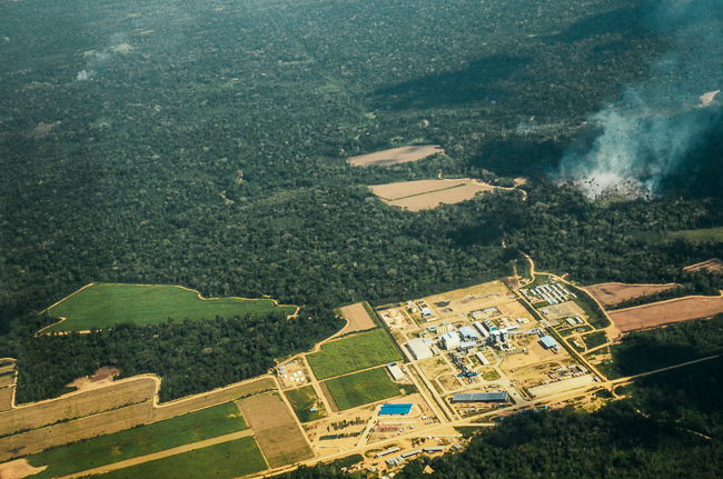
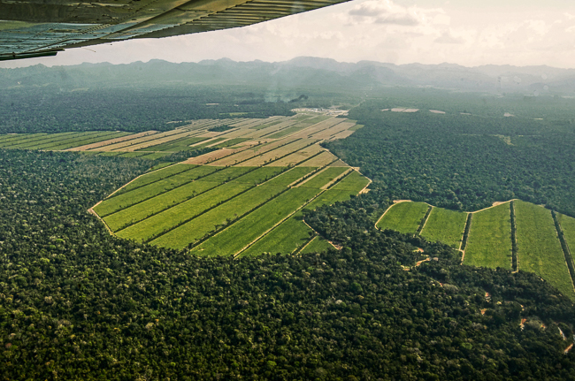
In only a few minutes, the young pilot, Henry Ruiz, beckons to direct our gaze to a completely different landscape that is coming from the left side of the aircraft. Just 12 kilometers from Madidi National Park, we can observe thousands of hectares of the Bolivian Amazon that have been razed and replaced by large sugar cane plantations.
Satellite data from the University of Maryland and visualized on the forest monitoring platform Global Forest Watch show that about 1,300 hectares (13 square kilometers) were deforested near San Buenaventura’s sugar refinery between 2011 and 2014. Then, late last month, Planet Labs detected a recent ramp-up in clearing activity, with around 600 more hectares affected near the mill and another 240-hectare area of deforestation to the west of the refinery. This latter area was cleared between July and September 2016, and was covered in primary forest as of the year 2000. This ongoing deforestation can be seen clearly from the air, and is happening just outside one of the world’s most biodiverse protected areas.
The sugarcane plantations and refinery that are displacing forest are owned by the company Empresa Azucarera San Buenaventura (EASBA) and condoned by Bolivia’s government, which says the project will benefit the country’s economy. The company was created by Supreme Decree No. 637 on September 15, 2010, in the San Buenaventura Municipality of northern La Paz Department. The sugarcane project was executed by Chinese company Camce Union Engineering (CAMC), with a governmental investment of $263 million. The goal, according to the Bolivian government, is to produce and sell sugarcane and its derivatives, thus encouraging domestic production with a vision of respect for nature.
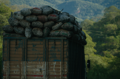
On October 29, 2015, President Evo Morales and Vice President Álvaro García Linera inaugurated the first harvest test of the sugar mill, which today is processing its first commercial harvest. The 2016 harvest is expected to process 78,000 metric tons of sugarcane, a quantity that will produce 14,000 metric tons of white sugar and one million liters of alcohol. To achieve this goal 1,300 hectares of sugarcane have been planted – equivalent to 2,500 football fields – without counting the construction of 290 kilometers of roads to facilitate the transportation of the product.
Production – and associated land conversion – is expected to dramatically increase in the coming years. According to Ramiro Lizondo, general manager of the mill, EASBA expects that by 2023 11,700 hectares will be needed to fully supply the refinery, for a total estimated production of 120,000 metric tons of sugar.
How to supply a giant sugar mill
Felipe Brígido is the leader of the Federation of Colonists of Rurrenabaque (FECAR) — the Rurrenabaque Municipality — a group of 74 communities, each with 20 to 40 families. Each household has in its possession an average of 25 to 50 hectares of land. These farmers are known as “intercultural” because they are mostly migrants from the western Bolivian Andes, from departments like Potosí, Oruro and La Paz.
“If they do not let us slash-and-burn and clear the forest then the sugar mill is a ‘white elephant’ in half the Amazon,” Felipe Brígido told Mongabay Latam. He also explained that if sugarcane is not produced in the municipalities of Rurrenabaque, San Buenaventura and Ixiamas, then the processing capacity of the mill will not be reached.
The Land Use Plan is a technical instrument recognized by the Bolivian legislature that regulates land use. This tool is seen today as an impediment to FECAR producers. The Land Use Plan of the department of Beni states that 60 percent of the territory of the Rurrenabaque Municipality is occupied by the Pilón Lajas Biosphere Reserve, 5 percent by rivers and wetlands, and the remaining 35 percent by areas of forest with different types of vegetation. Communities that belong to FECAR want to transform the forested portion into a productive area.
To do this, Brígido said they are making arrangements with senators and deputies of the Plurinational Legislative Assembly, to make changes to the Beni’s Land Use Plan and allocate 35 percent of the land for agricultural production.
“Not all farmers have the same production, some have livestock — 80, 90 or 100 cows, some even 200 — others plant banana, watermelon, squash and rice, and others are harvesting sugarcane and have formed the ‘Cañeros’ Association,” Brígido told Mongabay Latam. “We are small producers, so we want to produce in the rest of the territory.”
Germán Patzi is the leader of the Cañeros Association of Rurrenabaque, a newly formed organization with 40 members, which have between five and six hectares per family, and who are planting sugarcane. According to Patzi, it takes nine months between planting cane and harvesting it. According to Patzi, sugarcane absorbs most nutrients from the soil, necessitating a five-year crop rotation and preparation of new land.
“In the municipality of San Buenaventura, some producers have between 10 and 50 hectares of sugarcane already cultivated. EASBA has lent them planting machines,” Patzi told Mongabay Latam. “I think that sugarcane will be missing in the mill, they do not have much production.” He said that EASBA has interest in providing machines to farmers plow their crops, as well as granting loans for sugarcane production in amounts of up to $3,000 per hectare.
The impacts of deforestation
According to Dalia Flower, Councilor of the San Buenaventura Municipality, the sugar mill is causing a radical change in previously intact forests and threatening the wildlife that inhabits them, violating the rights of the indigenous community Tacana, and encouraging several communities to cut down the forest to produce sugarcane.
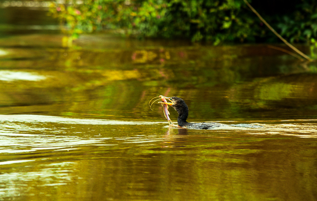
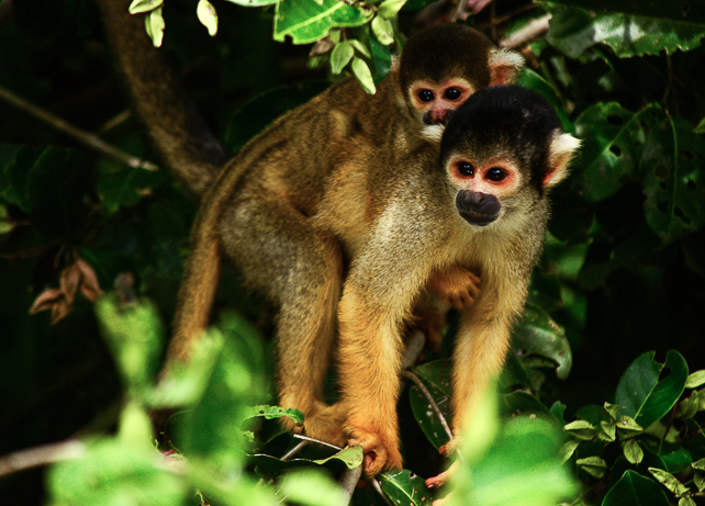
“The machines are treading the yellow-spotted river turtle (Podocnemis unifilis), red brocket deer (Mazama americana) and peccaries (Tayassu pecari),” Flower told Mongabay Latam. “I have seen monkeys with their young injured. It has polluted streams and communities. As people who cannot do anything, we feel helpless. We as the municipality cannot do anything.”
Hipólito Vidaurre, one of the other councilors, has a different opinion. Vidaurre said that the impacts depend on how you see them; most deforestation in San Buenaventura occurred before 1996, and it is on the fallow lands that are left where sugarcane is planted today.
However, from the air, the picture appears very different: the fallow lands that Vidaurre mentioned are not perceptible, with cleared areas pockmarking verdant rainforest. Deforestation is seen in several patches around the sugar mill. In some cases, smoke can be seen emanating from cleared land. Other patches already have sugar cane plantations. In this region of the San Buenaventura Municipality, the “green ocean” begins to look like a chessboard.
Global Forest Watch also shows that the area in which the newest, fastest clearing is happening was covered by an Intact Forest Landscape in 2000. Intact Forest Landscapes (IFLs) are tracts of particularly pristine, continuous primary forest that are undisturbed enough to retain their original levels of biodiversity.
Gladys Ybaguari, a Tacana Indigenous woman in the city of Tumupasa, agrees with Vidaurre. The Tacanas consider the region their ancestral territory and represent 29 percent of the total population of the municipality. Ybaguari is the president of the Tacana Indigenous Women’s Council of the Indigenous Center of the Tacana People (CIPTA). She told Mongabay Latam that her people are experiencing substantial impacts due to the sugar mill – primarily from forest clearing.
“We are dedicated to hunting, fishing and gathering fruit, we are now feeling the drought of the streams and this is due to the clearings,” Ybaguari said. “Intercultural people are [using machinery to harvest] wood to sell…. [before,] we took advantage of the forest with an ax and machete in a sustainable manner.”
Sandro Marupa, Secretary of Gender, Culture and Tourism of the CIPTA, explained that although the sugar mill was something that the Department of La Paz has been working towards since the 1970s, in recent years it failed to reach a consensus with the Tacana indigenous people. Yet, the Tacana claim that the government forced them to concede 4,000 hectares of Native Indigenous Territory (TIOC) for the construction of the sugarcane project.
“Due to the lack of financial resources we were not able to attend international courts to defend our rights,” Marupa said. “It’s crazy that as soon as they saw the paths being constructed, they began to remove the timber without any authorization,” he added, describing how the construction of the sugar mill’s new roads has led to illegal logging that is now affecting indigenous families and wildlife.
EASBA: a threat to Madidi
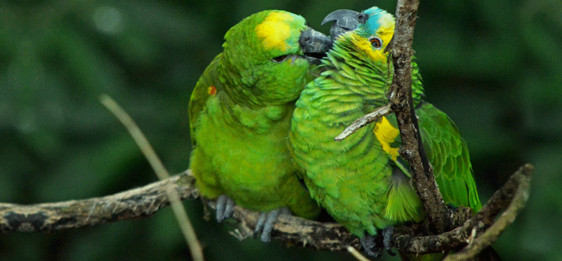
Madidi National Park and Natural Integrated Management Area is considered one of the world’s most biodiverse natural areas. Currently, an expedition called “Identidad Madidi” consisting of dozens of researchers from many Bolivian institutions as well as U.S.-based Wildlife Conservation Society (WCS), is surveying the park’s varied ecosystems. In its first year, the team uncovered seven species new to science and recorded more than 1,000 different birds, amid other discoveries. In all, scientists estimate Madidi contains 70 percent of Bolivia’s bird species.
The EASBA is located only 12 kilometers from Madidi National Park and Natural Integrated Management Area. According to Jose Luis Howard, chief park ranger of Madidi National Park, the sugar mill is a threat to this protected area. In particular, Howard is worried about the large production capacity of the mill.
“This will mean [converting] new hectares of forest,” Howard told Mongabay Latam. “Before, in these sectors, they carried out some agriculture, but three years ago they started to plant sugarcane.”
Where are they planting sugarcane?
Thirty-two percent of the area of the San Buenaventura Municipality is occupied by Madidi National Park and Natural Integrated Management Area, which together cover an area of 1,209 square kilometers. Of the portion of the municipality outside these protected areas, 86 percent is covered in primary forest, equivalent to 322,741 hectares. In comparison, fallow areas occupy 3.6 percent.
The Municipal Land Use Plan (PMOT), developed with the support of the NGO Conservation International, determined that in 2009 most of the foothill forest of San Buenaventura was in good conservation conditions. The PMOT also mentions that these forests, according to IUCN and CITES, harbor endangered, endemic and game species.
The PMOT also states that this particular ecosystem is highly affected by human settlements and logging activities, causing the movement of animals to yet-undisturbed areas. In the areas best preserved it is possible to observe gray brocket deer (Mazamagouazoubira), red brocket deer (Mazama americana), ferrets (Galictis vittata), badgers (Nasua nasua), pygmy anteaters (Cyclopes didactylus), tapirs (Tapirus terrestris), black-striped capuchin (Cebus libidinosus) and woolly opossums (Caluromys lanatus).
On December 23, 1991, Supreme Decree N. 23022 established the Abel Iturralde Province as a Reserva Natural de Inmovilizaciónzoning category, which includes the municipalities of San Buenaventura and Ixiamas. Later, in 2001, Supreme Decree No. 26075 declared 41 million hectares in the country as Permanent Forest Production Lands (TPFP), which includes 309,000 hectares of the municipality of San Buenaventura. According to this standard and the Forestry Law, burning and clearing in these areas is prohibited. However, certain land uses are permitted under the Forestry Use with Management Plans.
The PMOT also established limitations on the land use capacity in the municipality of San Buenaventura. In regard to sugarcane, according to a technical document, these soils do not have the necessary fertility because they have low levels of nutrients and organic matter. In other words, the land on which sugarcane is being cultivated is not actually conducive to sugarcane cultivation.
The future of the Pan Amazon
“It is very important that we go higher; we are approaching the Serranía de El Bala,” the Cessna pilot tells us. Demetrio Arce Canare, an indigenous Tsimane who is accompanying us in the aircraft, points to the Torewa community, where he and his family live. Canare contemplates how tiny the houses look from above.
Antonio Donato Nobre, a Brazilian scientist with Articulación Regional Amazónica (ARA), explained in his 2015 report “El Futuro Climático de la Amazonia” how climate models anticipated, more than 20 years ago, the various harmful effects of deforestation on the climate. Among these, a drastic reduction in plant transpiration, a change in the clouds and rain dynamics, and longer dry seasons. Nobre underlined the importance of dramatically reducing deforestation, forest degradation, and fire via any mean possible in order to avoid ecological catastrophe.
“The current [rates of] deforestation affect almost 20 percent of the original coverage of the entire Pan Amazon, and if the same pace continues and we choose not to recover the damaged Great Forest, the theory suggests that the Amazon system will collapse in less than 40 years,” Nobre states in his report.
According to the Friends of Nature Foundation (FAN), deforestation in Bolivia had reached 248,000 hectares per year by 2013. While clearance rates have stabilized some, they are still some of the highest in Latin America.
Landing at the Rurrenabaque airport, a smell of smoke appears and grows inside the cabin. The landscape before us turns almost completely white with haze.
“What a disgrace, they are slashing-and-burning!” said Henry Ruiz, while he does some maneuvers to avoid the smoke. Once we clear it, we see in the distance the landing zone and we gradually leave behind the “green ocean.” It’s been 90 minutes since we took off and, according to the World Wildlife Fund (WWF), the lungs of the planet have lost the equivalent of 270 football stadiums of trees, many of them located in Bolivia’s Amazon.